
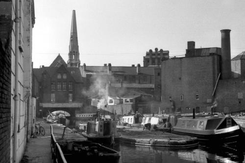
Basin at the junction of the Worcester & Birmingham Canal and the Birmingham Canal Navigation.
Gas Street, Birmingham
Gas Street Basin is a canal basin in the centre of Birmingham, where the Worcester & Birmingham Canal meets the BCN Main Line.
The Birmingham Canal, completed in 1773, terminated at Old Wharf beyond Bridge Street. When the Worcester & Birmingham Company started their canal at a point later known as Gas Street Basin, the Birmingham Canal Navigations Company (BCN) insisted on a physical barrier to prevent the Worcester & Birmingham from benefiting from their water. The Worcester Bar, a 7 ft. 3 in. wide straight barrier 84 yards long was built perpendicular to the run of the two canals. Cargoes had to be laboriously manhandled between boats on either side.
The Worcester & Birmingham Canal opened between Birmingham and Selly Oak in 1795 but took until 1815 to complete to Worcester, at which time - after much lobbying by iron and coal masters and the Worcester & Birmingham - an Act of Parliament was passed to open up the bar and the bar lock was built. There were toll offices either side of the bar lock and tolls were collected by each company from boats using the canals. The Worcester Bar still exists, with boats moored to both sides of it. It is connected to Gas Street via a footbridge, reconstructed to a design by Horseley Ironworks of the 19th century.
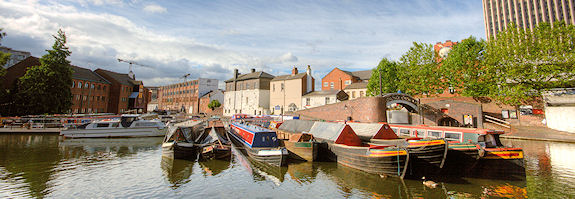
During the 1990s much of the area around the basin was redeveloped and the older buildings - many Grade II Listed - were refurbished.


By road: Located on Gas Street, off Broad Street, and between the Mailbox and Brindley Place canal-side developments.
By rail: Birmingham New Street is five minutes walk away.
Atterbury, Paul, English Rivers and Canals, Weidenfeld Nicolson Illustrated, ISBN 0 297 78318 1 (1984)
Bartholomew, Nicholson Inland Waterways Map of Great Britain, Bartholomew, ISBN 978-00072 11173 (2006)
Boughey, Joseph, Hadfield's British Canals: the Inland Waterways of Britain and Ireland, Sutton Publishing, ISBN 978 18401 50247 (1998)
Boughey, J. and Hadfield, C., British Canals: A Standard History, The History Press, ISBN 978-07524 46677 (2008)
Burton, A., Waterways of Britain, Collins Willow, ISBN 0 00 218047 2 (1983)
Gladwin, D.D., A Pictorial History of Canals, Batsford, ISBN 0 7134 0554 6 (1977)
Pratt, D. Waterways Past and Present: A Unique Record of Britain's Waterways Heritage, Adlard Coles Nautical, ISBN 978-07136 76341 2006)
Pratt, F., Canal Architecture in Britain, Shire Publications, ISBN 978- 09032 18139 (1976)
Roberts, B., Britain's Waterways: A Unique Insight, GEOprojects, ISBN 978- 08635 11158 (2006)
Rolt, L.T.C., Inland Waterways of England, Allen & Unwin, ISBN-10: 0043860036 (1950)
Shill, Ray.,Birmingham Canal Navigations, The History Press, ISBN 978 07524 27676 (2002)
Ware, M.E., Britain's Lost Commercial Waterways, Landmark Publishing ISBN 978-18430 61816 (2005)
